Elk Habitat Map · Idaho
Less e-scouting. More hunting.
Our habitat suitability model scores the terrain across your whole unit and shows you where elk are likely to be. It takes most of the e-scouting off your plate. You still have to do the work to get to the elk — but you'll know where to start.
Coming soon · In testingHow it thinks
It reads a unit the way you would.
Ask a seasoned elk hunter how they pick country and you'll hear the same things: north- and south-facing slopes, good bedding, feed and water close by, and how much pressure a spot gets. The map weighs all of it across the entire unit you're hunting, at once.
Under the hood is our elk habitat suitability model. It scores the geographic features of every spot in the unit and rolls them into one habitat score — so the hotspots stand out, and the best spots are ranked so you know where to spend your days.
Take a look
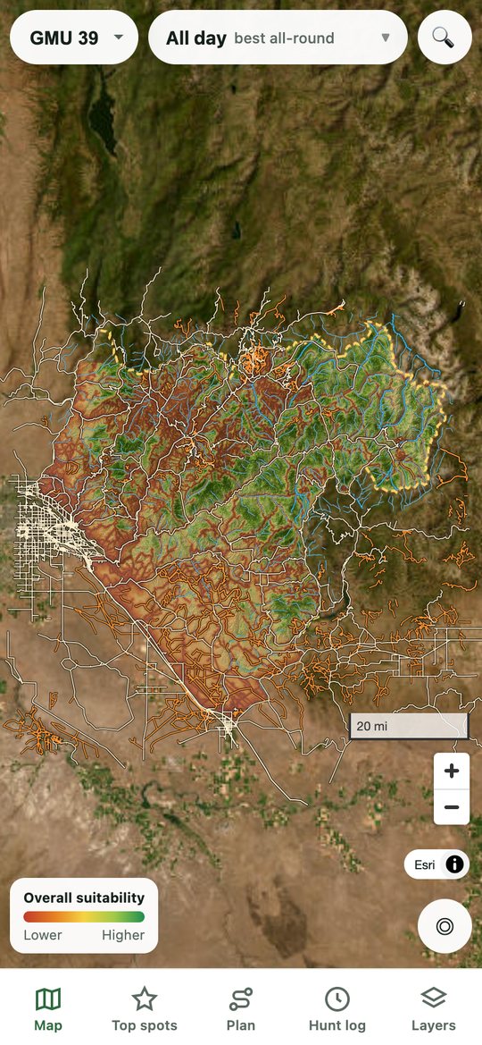
Idaho unit 39, scored.
This is a preview of the habitat map for one Idaho unit. Greener ground scores higher for elk; red scores lower. Pan and zoom around. Detail down to the drainage, the reasons behind every score and route planning come with the app.
Preview only — the shading is deliberately coarse. White lines are drivable roads. Basemap: USGS The National Map; roads © OpenStreetMap contributors.
What you get
Built for the hunt, not the couch.
See where elk are likely to feed at first light, bed at midday, and move in between.
Every spot shows why it scores the way it does, in plain hunter terms.
Start with the best country in the unit instead of guessing.
Pick your fitness level and it plans your way in like a seasoned guide would — working with the terrain instead of straight up it, with honest time estimates. Log a few hunts and it learns your actual pace.
Set how much brush you're willing to fight and the route changes with you.
Save a whole unit to your phone before you lose signal.
Send your pins to the other hunting map apps you already use.
Hunt logs, tracks and pins are private.
See why elk use a place, so newer hunters learn to read the land.
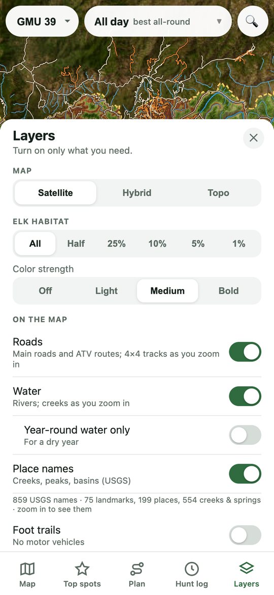
Real screenshots from the current test version (Idaho unit 39). Satellite imagery: Esri.
The map gets you to the right spot.
The rest is up to you.
Coverage
Idaho first.
The test version covers these Idaho hunting units. More country is coming — sign up and tell us where you hunt.
- Unit 22
- Unit 36
- Unit 39
- Unit 43
- Unit 69
What the map is — and isn't. Scores compare places within a unit; they're not a head count and not a promise you'll find elk. The model is still being tested against field data. Always confirm land access and hunting regulations yourself before you go.
Coming soon
Be first to know.
Sign up and we'll email you when the Elk Map is available — or when the map goes live in an area near you.
Screenshots: satellite imagery © Esri and its data providers; topo basemap © OpenTopoMap (CC-BY-SA); © OpenStreetMap contributors.